
Key points
- UK sees a cooler start to the week after recent heatwave
- Temperatures forecast to rise again by Wednesday in parts of England
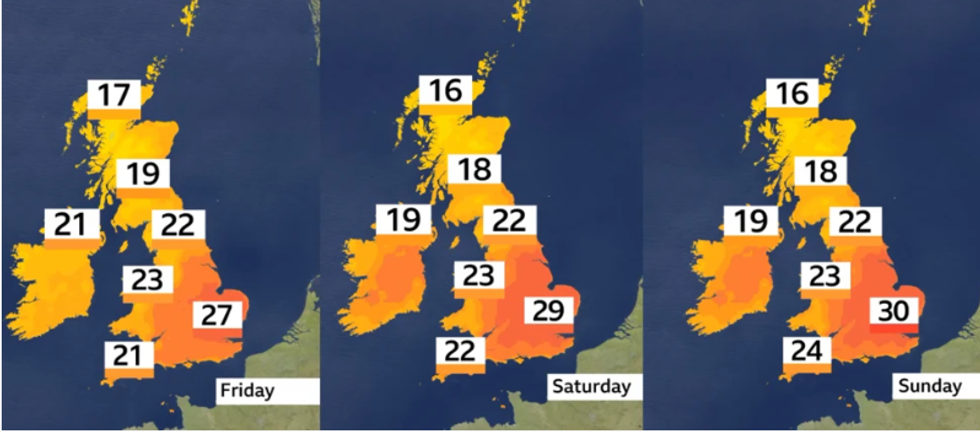
- Midlands, eastern and southeastern England could see highs of 30°C
- Overnight humidity may lead to heavy, thundery showers midweek
- Glastonbury and Wimbledon expected to enjoy mostly dry, warm weather
Warm spell returns after short-lived fresher weather
The UK has started the week with a noticeable drop in temperatures after the recent spell of hot weather. However, this break from the heat is expected to be brief, with forecasters predicting a second rise in temperatures for parts of England by midweek.
A south-westerly airflow replacing the recent westerlies will begin drawing warmer air back into the country. This shift means areas in central and southeastern England could again see temperatures reaching the high twenties by Wednesday, bringing the possibility of a second UK heatwave, especially across eastern regions.
Cooler conditions to begin the week
Monday and Tuesday will feel much fresher across most of the UK, with daytime highs ranging between 17°C and 24°C, closer to the seasonal norm for June. A mix of sunny spells and scattered showers is expected, and brisk winds may affect northern and western areas.
These conditions are typical for a British summer, with overnight rain possibly delaying Tuesday’s cricket at Headingley.
Temperatures to climb again by midweek
From Wednesday, the wind direction will shift to a south-westerly flow, bringing warmer and more humid air into parts of England. The Midlands, eastern and southeastern regions are likely to see temperatures rise rapidly to between 26°C and 29°C.
 The early part of next week looks set to continue the warm trendMET Office
By Friday, some locations could reach 30°C (86°F), especially in eastern England. While not all areas will meet the Met Office’s heatwave criteria (three consecutive days above threshold temperatures), a second UK heatwave weather forecast remains possible for certain regions.
Rain and thunderstorms possible midweek
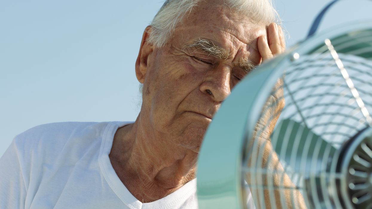
The increasing humidity could trigger a band of heavy, thundery showers on Wednesday night, spreading from west to east. Overnight temperatures in the east may remain high, between 15°C and 17°C, making sleeping conditions uncomfortable for some.
Thursday dip followed by warmer weekend
Thursday is likely to feel fresher again, with temperatures dipping slightly before warmer weather returns towards the weekend. The Midlands and southeast could again see highs in the high twenties or low thirties, while the rest of the UK experiences more moderate temperatures.
Glastonbury set for dry spells after wet start
Festivalgoers heading to Glastonbury will enjoy a warm and dry start on Wednesday, with temperatures around 25°C. However, the overnight thundery band of rain may result in a muddy start to Thursday. Conditions are forecast to improve later in the day, settling into a pattern of dry, sunny spells for the remainder of the festival.
Wimbledon to enjoy fine opening week
The start of Wimbledon next week is also expected to benefit from favourable weather. Highs in the high twenties are likely on Monday, easing slightly to the mid-twenties for the rest of the week. While there’s always a chance of brief interruptions, the overall outlook remains dry and warm.
Outlook into next week
The early part of next week looks set to continue the warm trend, especially in the south and east. Although not widespread, the second UK heatwave weather forecast suggests that high temperatures and dry spells may persist in some regions.
For accurate and up-to-date information, the Met Office continues to monitor conditions and will issue official heatwave alerts if thresholds are met.