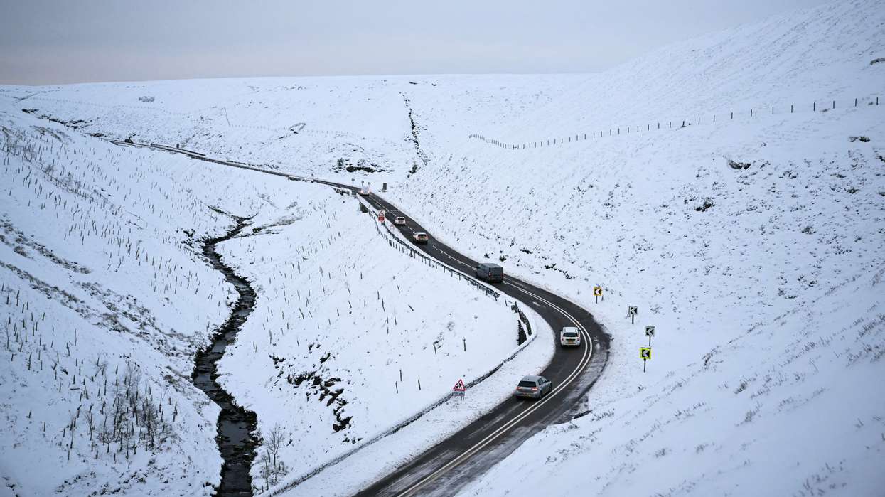

- A yellow ice warning covering parts of Scotland and northern England remains in force until 10am on Monday
- A separate snow warning will cover parts of the Midlands, northern England and southern Scotland from midnight until noon on Tuesday
- Up to 15cm of snow could accumulate on higher ground, potentially affecting roads, railways and power supplies
Parts of the UK are facing icy roads, snowfall and possible travel disruption as a cold spell brings wintry conditions to northern areas at the start of the week.
The Met Office has issued a yellow warning for snow covering parts of the Midlands, northern England and southern Scotland from midnight until 12pm on Tuesday (17). While lower-lying areas could see temporary snowfall, higher ground is expected to face the greatest risk of accumulation.
The warning follows a spell of Arctic air that brought freezing temperatures and frost across much of northern Britain overnight. A separate yellow warning for ice, covering parts of Scotland and northern England, remains in force until 10am on Monday.
The cold conditions are also prompting health concerns. The UK Health Security Agency (UKHSA) has issued yellow cold health alerts for north-west England, north-east England and Yorkshire and the Humber until 9am on Thursday, November 19.
The weather is expected to vary considerably across the country, with colder conditions in the north contrasting with milder, wetter weather in southern areas.
Which areas are covered by the snow and ice warnings?
The Met Office's yellow ice warning covers parts of northern and eastern Scotland, including Aberdeen, Aberdeenshire, Angus, Dundee, Fife, Highland, Moray and Perth and Kinross. Parts of southern Scotland, including Edinburgh, the Scottish Borders and Dumfries and Galloway, are also affected.
In England, the warning covers Cumbria, Durham and Northumberland. It remains in force until 10am on Monday.
The forecaster warned that showers of rain, sleet and hill snow could fall onto surfaces that are already below freezing, creating icy stretches on untreated roads, pavements and cycle paths.
A separate yellow snow warning will come into effect from midnight on Tuesday until noon, covering the following areas:
- East Midlands: Derbyshire and Nottinghamshire.
- North East England: Darlington, Durham, Gateshead, Newcastle upon Tyne and Northumberland.
- North West England: Blackburn with Darwen, Cheshire East, Cumbria, Greater Manchester and Lancashire.
- West Midlands: Staffordshire and Stoke-on-Trent.
- Yorkshire and the Humber: North Yorkshire, South Yorkshire and West Yorkshire.
- Southern Scotland: East Ayrshire, South Ayrshire, South Lanarkshire, Dumfries and Galloway, Midlothian and the Scottish Borders.
The Met Office expects a band of rain moving northwards to turn to snow as it encounters colder air. The snowfall is most likely to affect locations above 100 metres, while any snow at lower levels is expected to be temporary and melt relatively quickly.
Where snow settles, accumulations of 1-5cm are forecast. Some areas above 300-400 metres could receive between 5cm and 15cm.
Strong easterly winds could cause localised drifting on higher routes. The Met Office has also warned of possible ice build-up on power lines, which could contribute to disruption to electricity supplies.
Road and rail journeys could take longer, particularly across higher routes and exposed areas. Motorists and public transport passengers have been advised to check conditions before travelling.
How long will the cold weather last?
Monday (16), is expected to begin cold, with the lowest temperatures across northern England, Scotland and Northern Ireland. Many areas will see sunny spells after early showers clear, although wintry showers are expected to continue in parts of northern Scotland.
The Met Office forecast also points to persistent rain moving into south-western areas later on Monday. This band of rain is expected to travel northwards overnight, bringing a risk of snow over higher ground as it meets colder air.
Tuesday will be wet and windy across much of the country. Heavy, potentially thundery showers are forecast in the south, while northern areas are expected to experience persistent rain. Northern Scotland should see brighter conditions with scattered showers.
The contrast between northern and southern weather is expected to continue through the middle of the week. Temperatures in southern areas are forecast to return closer to seasonal averages, while northern parts remain colder.
The UKHSA's yellow cold health alerts cover north-west England, north-east England and Yorkshire and the Humber until 9am on Thursday. These alerts are intended to warn health and social care services about potential effects on vulnerable people, including increased demand for healthcare and greater risks to those who are more susceptible to cold weather.
The agency advises people to check on older relatives, neighbours and others who may be vulnerable during colder conditions.
The Met Office's latest outlook suggests a changeable pattern will continue towards the end of the week, with showers in the south and colder, brighter conditions developing in the north.
The current warnings are therefore focused on specific regions rather than a nationwide snow event. Travellers are advised to check local forecasts and transport updates, particularly before setting out early on Tuesday when the risk of snow and ice is expected to be greatest.





 Modi, who has lived in London for several years, shared the news on X X/@LalitKModi