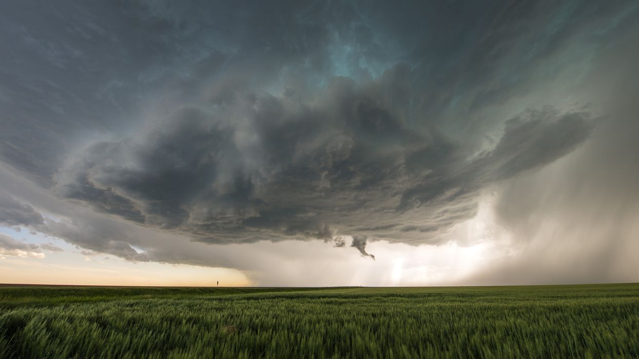

The Met Office has issued a tornado warning, with the possibility of a funnel cloud forming across parts of southern England, as the region faces thunderstorms following an unusually dry spring.
Met Office meteorologist Alex Burkill said on Wednesday that it was “not out of the question that we could see a funnel cloud, maybe even a brief tornado across parts of the South East.” The warning comes as heavy showers, lightning and hail are forecast to affect southern areas, while northern regions enjoy largely fine and sunny weather.
“There’s a bit of a North-South split today,” Burkill noted. “Northern parts are seeing a lot of sunshine, while the South is experiencing wet weather that will continue with further showery bursts.”
The warning follows what has been recorded as the driest start to spring in nearly six decades. By Friday, just 80.6mm of rain had fallen across the UK during spring 2025—almost 20mm less than the lowest ever total for a full spring season, which was 100.7mm in 1852.
The Environment Agency has cautioned that prolonged dry periods could contribute to drought conditions later in the summer if rainfall remains limited.
Drier weather expected from Thursday
More settled weather is expected to return from Thursday, with only a few light showers forecast in the South West. These are not predicted to be as intense as Wednesday’s downpours.
“There’ll be a good amount of sunshine elsewhere,” Burkill added.
Friday is likely to remain mostly dry and fine across much of the country, though more wet and windy conditions are forecast to develop over the weekend, bringing a shift in the weather once again.
Burkill said this week’s unsettled spell marked a “real change from what we’ve become used to so far this spring,” highlighting how consistently dry conditions have been up to now.
The Met Office tornado warning highlights the unpredictability of current patterns, even as much of the UK continues to grapple with a spring notable for its lack of rainfall.