
The Met Office has issued an amber weather warning for thunderstorms across parts of eastern and south-eastern England, in effect from 20:00 BST on Friday to 05:00 on Saturday. The affected area spans from Eastbourne in East Sussex to Cromer in north Norfolk.
The warning indicates a high risk of disruption, with flash flooding, power cuts, and hazardous travel conditions expected. The Met Office warns that flooding of homes and businesses is likely, and delays or cancellations to bus and rail services are possible due to surface water and lightning strikes.
Heavy rain and strong winds forecast
According to the forecast, some locations within the amber zone could see between 30mm and 50mm of rainfall, accompanied by wind gusts exceeding 40–50mph. There is a heightened risk of frequent lightning and intense downpours, leading to flash floods and dangerous driving conditions.
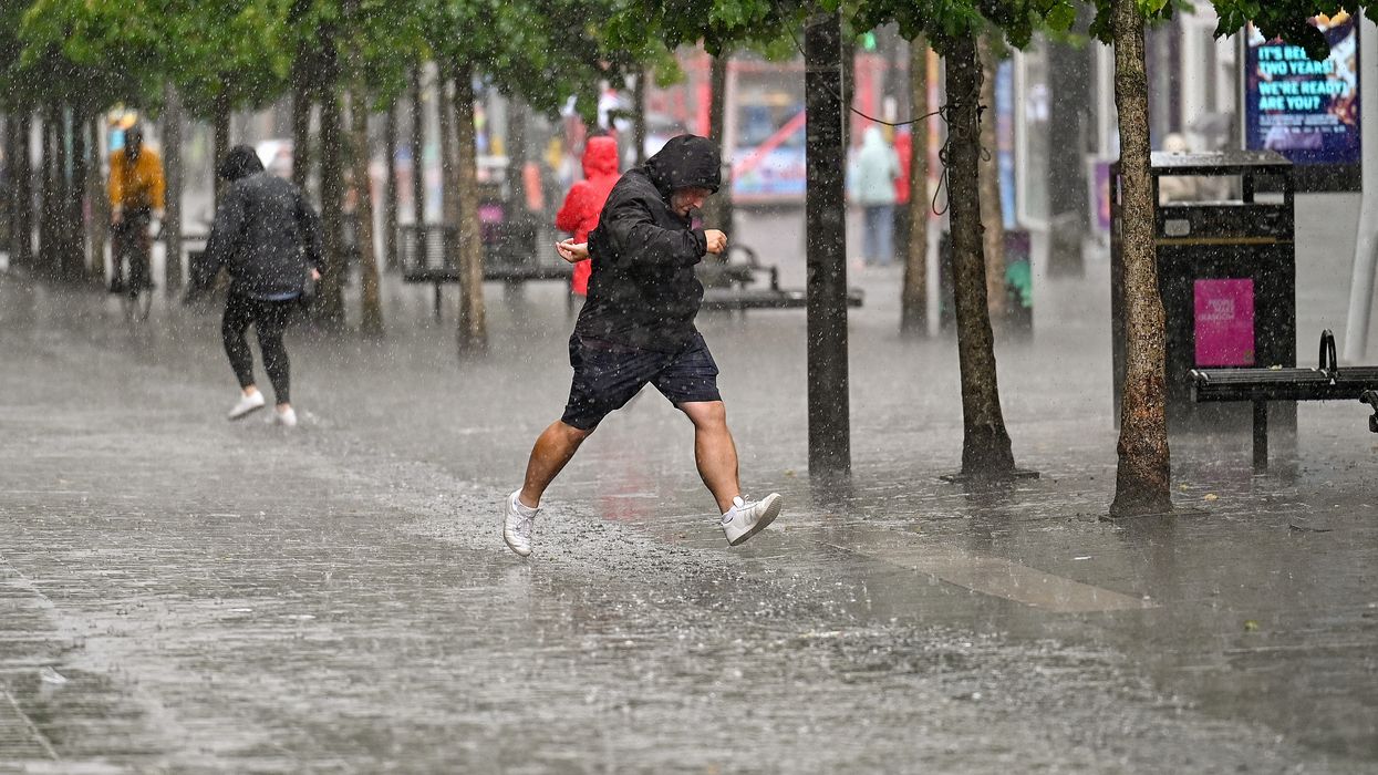
 The affected area spans from Eastbourne in East Sussex to Cromer in north NorfolkGetty Images
The Met Office said fast-flowing or deep floodwater could pose a danger to life. People are advised to remain indoors during the worst of the weather and avoid unnecessary travel. Where travel is essential, extreme caution is urged.
Public urged to prepare
Residents in affected areas are being encouraged to check on vulnerable neighbours, especially those who may require assistance with food or medication. The Met Office recommends staying updated with local forecasts, charging electronic devices in advance, and securing outdoor furniture or loose items.
Yellow warnings cover wider region
Alongside the amber alert, several yellow thunderstorm warnings have also been issued:
- South-west England and Wales: 14:00–23:59 on Friday
- Eastern and south-eastern England: 19:00 on Friday to 06:00 on Saturday
- Wales, western and northern England, and Scotland: 00:00–18:00 on Saturday
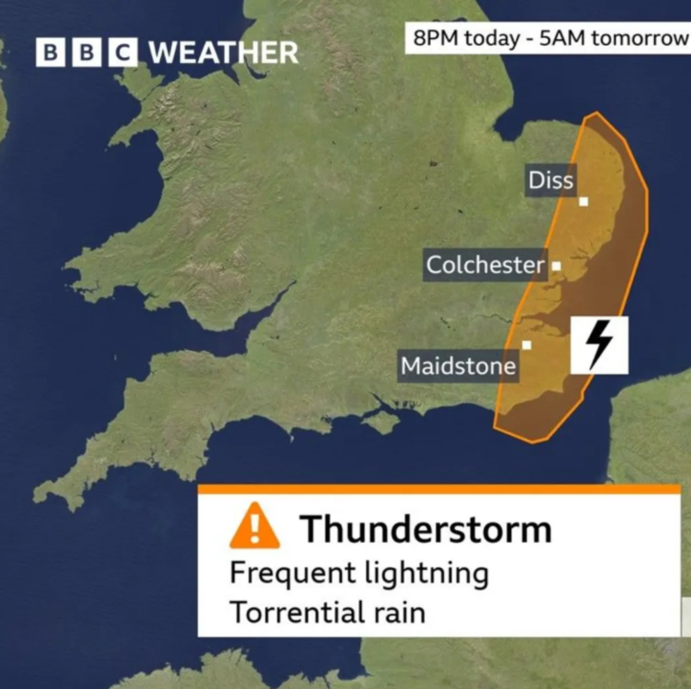 Heavy rain and thunderstorm warningBBC
Although yellow warnings indicate a lower risk than amber, the severity of thunderstorms could still be high in isolated areas. The warning for Saturday covers more of the UK as the storm system moves westward.
Heatwave peaks before storms arrive
The weather alert comes as Friday could become the hottest day of 2025 so far, with temperatures possibly hitting 30°C around the Norwich area. This would surpass the previous high of 29.3°C recorded at Kew, London, on 1 May.
Elsewhere across East Anglia and south-east England, temperatures are expected to reach the mid to high twenties, which is about 7–10°C above the seasonal average.
Cooler weekend ahead
With rising humidity and atmospheric instability, the thunderstorms are expected to mark the end of the hot spell. Saturday will bring cooler conditions, with temperatures dropping to the low to mid-twenties in the east and the high teens across other parts of the UK.
The Met Office continues to monitor the situation and has advised the public to follow the latest forecasts and travel updates.