
- Nearly 3,000 lightning strikes were recorded over London in around two hours.
- Flooding disrupted roads, rail services and Heathrow Airport transport links.
- Temperatures could reach 40°C later this week, prompting rare red heat warnings.
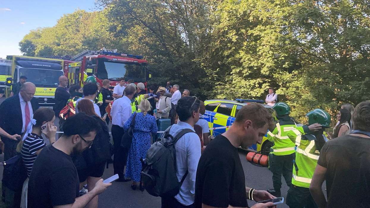
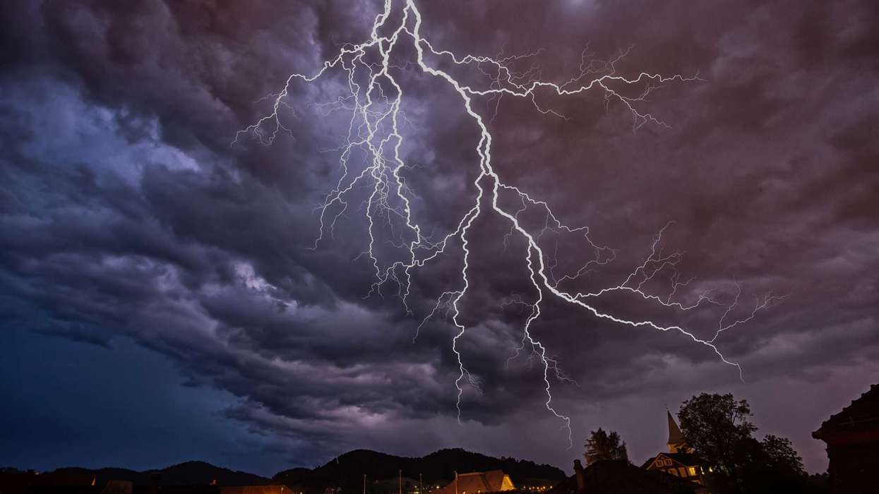
London was hit by a night of thunderstorms, flash flooding and transport disruption in the early hours of June 23, just as forecasters warned that an exceptional heatwave could push temperatures close to 40°C later this week.
The intense storm system caught many by surprise. Thousands of lightning strikes lit up the skies across the capital while torrential rain flooded roads, disrupted rail services and prompted hundreds of emergency call-outs. The dramatic weather came only hours before rare red extreme heat warnings were due to take effect across large parts of England and Wales.
From flooded streets to fire calls
The thunderstorm swept across London for more than two hours overnight, bringing heavy rain and near-constant lightning. Meteorologist and catastrophe modeller James Cosgrove reportedly said on X, as quoted in news reports, that almost 3,000 lightning strikes had been recorded during the storm.
Residents across the capital shared images and videos of lightning flashes and flooded streets. Parts of west London, including Ruislip and Uxbridge, were among the worst affected. Social media users reported roads submerged under water and flooding around Ruislip Manor station, as quoted in news reports.
London Fire Brigade said it received around 400 calls overnight as crews responded to multiple flooding incidents. Firefighters also attended at least two house fires believed to have been caused by lightning strikes.
The weather disruption extended to transport networks. Flooding affected services on the Elizabeth line, with trains unable to operate between Heathrow Terminals 2 and 3 and Terminal 4. Services to Terminal 4 were terminated at Hayes & Harlington and West Drayton, creating difficulties for passengers travelling to the airport.
Storm before an extreme heat surge
While the storms brought temporary relief from the heat, forecasters say the hottest conditions are still to come.
The Met Office expects temperatures across southern England to rise sharply over the coming days, with some areas potentially reaching between 38°C and 40°C. If forecasts prove accurate, the UK's longstanding June temperature record of 35.6°C, set in Southampton in 1976 and matched in London in 1957, could be broken.
A red warning for extreme heat has been issued across a large stretch of England and Wales, covering areas from London and the South East to parts of the Midlands and South West. The warning runs from June 24 to June 25 and signals the possibility of severe impacts, including health risks, travel disruption and pressure on infrastructure.
Met Office Deputy Chief Forecaster Mark Sidaway reportedly said, as quoted in news reports, that red warnings are reserved for the most severe weather events and that the combination of extreme temperatures and high humidity could create significant impacts for a wider section of the population.
Health officials have also expressed concern about unusually warm nights. Temperatures in some areas may remain above 20°C overnight, limiting opportunities for recovery from the daytime heat.
The UK Health Security Agency has warned that the conditions could pose risks beyond traditionally vulnerable groups. Dr Agostinho Sousa, Head of Extreme Events and Health Protection at the agency, reportedly said in a statement that a red heat health alert indicates a potential risk to life even among otherwise healthy people.
Several schools across England and Wales have already announced plans to close early or adjust schedules as temperatures continue to climb.
For many Londoners, the contrast was striking. Within a matter of hours, the city moved from darkness and thunderstorms to bright sunshine and the prospect of one of the hottest June days ever recorded in the UK.