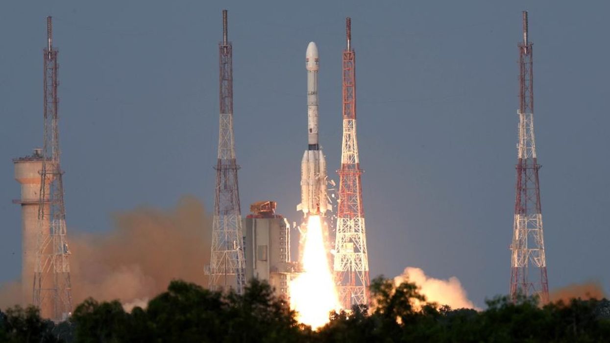

THE US and India on Wednesday launched a new radar satellite, NISAR (NASA-ISRO Synthetic Aperture Radar), to monitor changes in Earth’s land and ice surfaces and improve prediction of natural and human-caused hazards.
The satellite, about the size of a pickup truck, lifted off at around 5:40 pm (1210 GMT) from the Satish Dhawan Space Centre in southeastern India on an ISRO Geosynchronous Satellite Launch Vehicle rocket. Livestream footage showed schoolchildren and mission teams cheering as the launch took place.
US president Donald Trump and Indian prime minister Narendra Modi described the mission as a milestone in cooperation between the two countries. “Congratulations India!” India’s science and technology minister Dr Jitendra Singh posted on X, calling the mission a “game changer.”
GSLV-F16/NISAR
From a majestic liftoff to the flawless separation, witness the full journey.
Watch spectacular moments of NISAR launching aboard GSLV-F16 and its precise separation, captured on-board.
A milestone in global space collaboration.#ISRO #NASA #GSLVF16 #NISAR pic.twitter.com/BZkqRujFHd
— ISRO (@isro) July 30, 2025
Karen St Germain, director of NASA’s Earth Science division, said ahead of the launch, “Our planet surface undergoes constant and meaningful change. Some change happens slowly. Some happens abruptly. Some changes are large, while some are subtle.”
NISAR can detect vertical surface movements as small as one centimetre. Scientists expect this data to help in identifying early signs of earthquakes, landslides, volcano activity, and structural issues in dams and bridges. “We’ll see land substance and swelling, movement, deformation and melting of mountain glaciers and ice sheets covering both Greenland and Antarctica, and of course, we’ll see wildfires,” St Germain said, describing NISAR as “the most sophisticated radar we’ve ever built.”
India aims to use the satellite to study coastal and ocean areas, track changes near river deltas, and monitor shoreline shifts. The data will also support agricultural planning by mapping crops, assessing plant health, and measuring soil moisture.
The spacecraft will undergo a 90-day commissioning phase, during which it will deploy its 39-foot (12-metre) radar antenna reflector. Once operational, it will scan nearly all of Earth’s land and ice twice every 12 days from an altitude of 464 miles (747 kilometres), orbiting close to the poles.
The satellite transmits microwaves and collects surface echoes, with computer processing reconstructing high-resolution images. It uses two radar frequencies, L-band for tall vegetation and S-band for shorter plants.
NASA and ISRO collaborated on the project, with components built separately and integrated in Bengaluru. NASA contributed nearly $1.2 billion, while ISRO’s costs were around $90 million.
India’s space programme has achieved several milestones, including sending a probe to Mars orbit in 2014 and landing a robot and rover on the Moon in 2023. Recently, Indian Air Force test pilot Shubhanshu Shukla became the second Indian to travel to space and the first to reach the International Space Station, advancing India’s plans for its Gaganyaan crewed mission in 2027.
(With inputs from agencies)